|
B e l l a C o o l a G a l l e r y
|
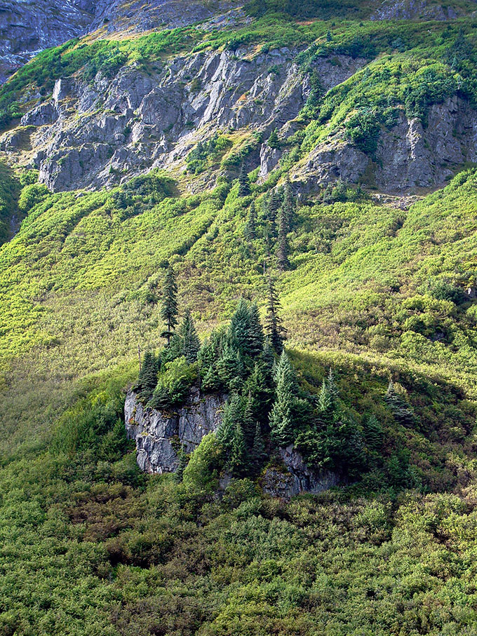
| Bella Coola is a small town at the end of North Bentinck Arm, a large coastal fjord about 200 miles north of Vancouver, British Columbia. The coastal valley it sits in is surrounded by 6 to 9,000 foot peaks that rise abruptly from the valley floor. This vally can be reached by a small coastal ferry from the west, or via a precipitous, cliff-hugging road from the east. |
|
| |
| |
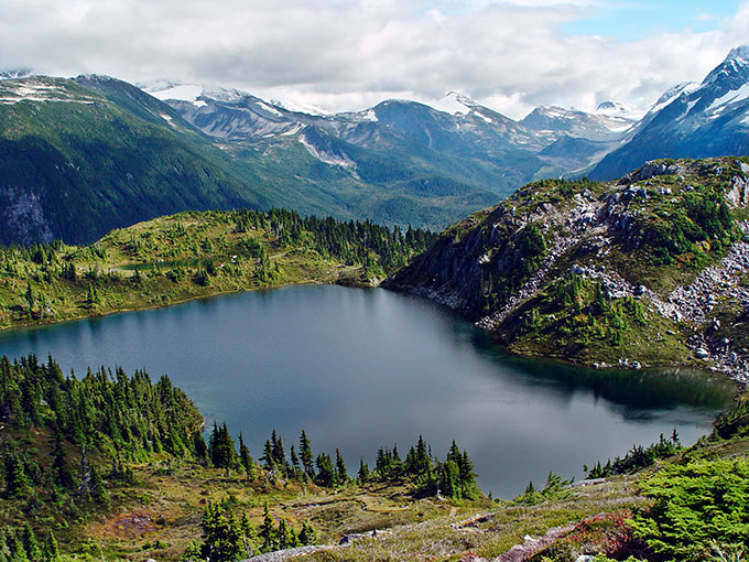
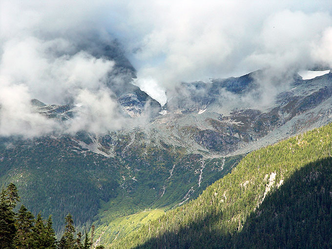
| M. Gurr Lakes, Bella Coola |
|
|
| Photo taken from the M. Gurr Lakes, near the end of Clayton Falls Creek road, southwest of Bella Coola, British Columbia. Clayton Falls Creek Road is a gut rattling road that has been maintained by removing old culverts and converting them to swales. What a view from the top! The ridges above the M. Gurr lakes stand at the junction of three large inlets: Burke Channel and North and South Bentinck Arms. |
|
|
|
Prints available in the following sizes.
Please query for stock use.
|
| |
| O t h e r P h o t o D a t a |
Sony Cybershot F707
28mm
hand held
F5.6, 1/500 second
ISO 100
|
|
| |
| |
|
|
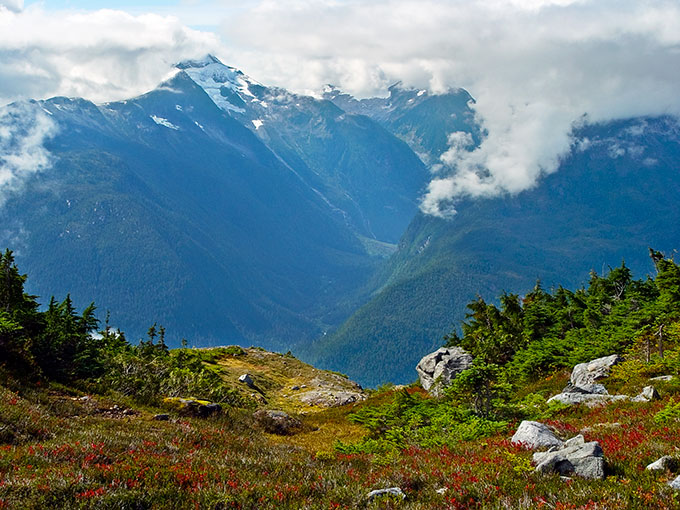
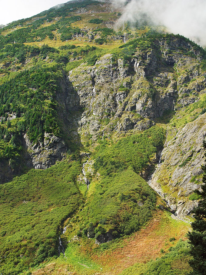
| Hanging Valley Across South Bentinck Arm |
|
|
Photo taken from the ridge above M. Gurr Lakes, looking southeast at the tangled, uninhabited canyons across South Bentinck Arm. Bella Coola, British Columbia.
|
|
|
|
Prints available in the following sizes.
Please query for stock use.
|
| |
| O t h e r P h o t o D a t a |
Sony Cybershot F707
28mm
hand held
F5.6, 1/500 second
ISO 100
|
|
| |
| |
|
|
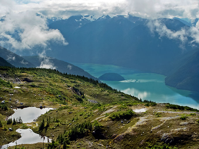
| South Bentinck Arm |
|
|
View of South Bentinck Arm and Bensins Island from the ridge above M. Gurr Lakes, Bella Coola, British Columbia.
|
|
|
|
Prints available in the following sizes.
Please query for stock use.
|
| |
| O t h e r P h o t o D a t a |
Sony Cybershot F707
28mm
hand held
F5.6, 1/500 second
ISO 100
|
|
| |
| |
|
|
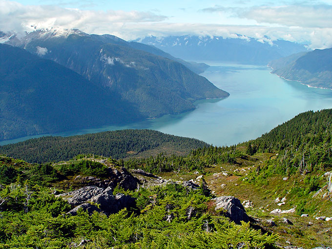
| Burke Inlet |
|
|
| View of Burke Inlet, with South Bentick Arm branching to the left and North Bentinck Arm to the right. Bella Coola, British Columbia |
|
|
|
Prints available in the following sizes.
Please query for stock use.
|
| |
| O t h e r P h o t o D a t a |
Sony Cybershot F707
28mm
hand held
F5.6, 1/500 second
ISO 100
|
|
| |
| |
|
|
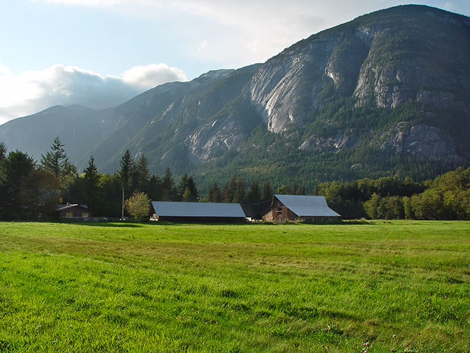
| Bella Coola Valley, Sunset |
|
|
Bella Coola valley at sunset, near Hagensborg, looking northwest. Bella Coola, British Columbia.
|
|
|
|
Prints available in the following sizes.
Please query for stock use.
|
| |
| O t h e r P h o t o D a t a |
Sony Cybershot F707
28mm
hand held
F5.6, 1/500 second
ISO 100
|
|
| |
| |
|
|
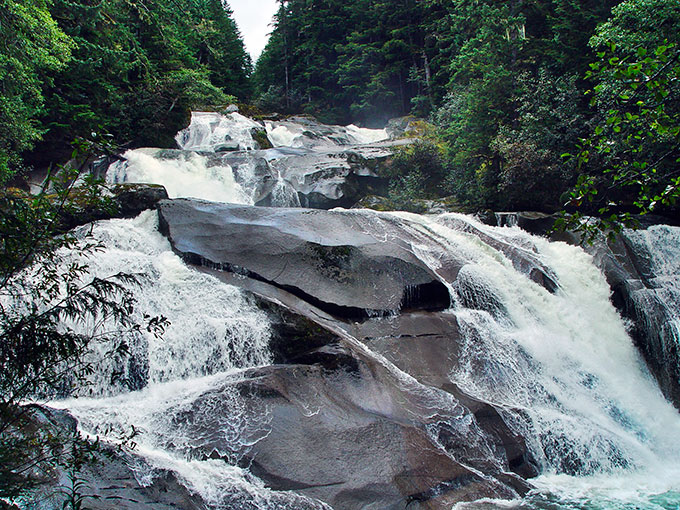
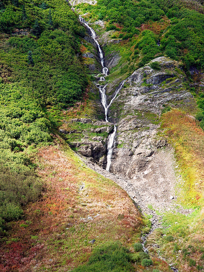
| Clayton Creek Falls |
|
|
Clayton Creek Falls is Clayton Creek's last tumble before it meets the salt water of North Bentinck Arm. The water is more vigorous and treacherous than this photo would suggest; a tourist was drowned in the falls the year before this picture was taken. Bella Coola, British Columbia.
|
|
|
|
Prints available in the following sizes.
Please query for stock use.
|
| |
| O t h e r P h o t o D a t a |
Sony Cybershot F707
28mm
hand held
F5.6, 1/500 second
ISO 100
|
|
| |
| |
|
|
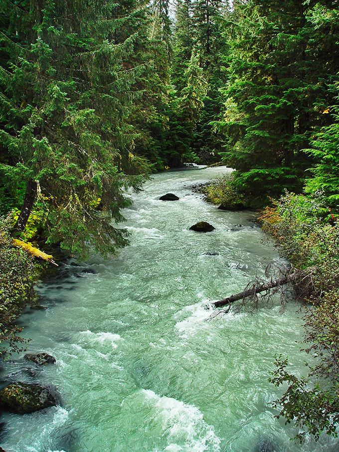
| Nusatsum River |
|
|
| View of the glacial-silt filled Nusatsam River from a bailey bridge above the Odegaard Falls trailhead. Bella Coola, British Columbia. |
|
|
|
Prints available in the following sizes.
Please query for stock use.
|
| |
| O t h e r P h o t o D a t a |
Sony Cybershot F707
28mm
hand held
F5.6, 1/500 second
ISO 100
|
|
| |
| |
|
|
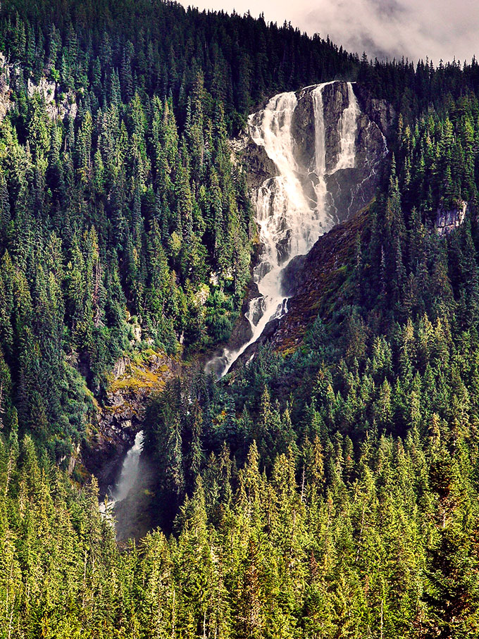
| Odegaard Falls |
|
|
| View of Odegaard Falls from the trailhead on the Nusatsum Forest Service Road, framed in patches of sunlight on a cloudy day. |
|
|
|
Prints available in the following sizes.
Please query for stock use.
|
| |
| O t h e r P h o t o D a t a |
Sony Cybershot F707
28mm
hand held
F5.6, 1/500 second
ISO 100
|
|
| |
| |
|
|
| Road to Odegaard Pass |

|
|
| View of the Nusatsum Forest Service road a few miles west of Odegaard Falls, on the way to Odegaard Pass. The peaks of the Nustatsum Divide are in the distance. Bella Coola, British Columbia. |
|
|
|
Prints available in the following sizes.
Please query for stock use.
|
| |
| O t h e r P h o t o D a t a |
Sony Cybershot F707
28mm
hand held
F5.6, 1/500 second
ISO 100
|
|
| |
| |
|
|
| Mountainside Above Odegaard Pass 1 |
|
|
| Brushy mountainside north of Odegaard Pass. This slope leads to a shoulder of an outlying ridge of Mount Saugstad, which is not visible from the pass. |
|
|
|
Prints available in the following sizes.
Please query for stock use.
|
| |
| O t h e r P h o t o D a t a |
Sony Cybershot F707
28mm
hand held
F5.6, 1/500 second
ISO 100
|
|
| |
| |
|
|
| Mountainside Above Odegaard Pass 2 |
|
|
| Crags and brush on the road above Odegaard Pass, Bella Coola, British Columbia. |
|
|
|
Prints available in the following sizes.
Please query for stock use.
|
| |
| O t h e r P h o t o D a t a |
Sony Cybershot F707
28mm
hand held
F5.6, 1/500 second
ISO 100
|
|
| |
| |
|
|
| Waterfall Above Odegaard Pass |
|
|
| Narrow cascade descending a gully above Odegaard Pass, Bella Coola, British Columbia. |
|
|
|
Prints available in the following sizes.
Please query for stock use.
|
| |
| O t h e r P h o t o D a t a |
Sony Cybershot F707
28mm
hand held
F5.6, 1/500 second
ISO 100
|
|
| |
| |
|
|
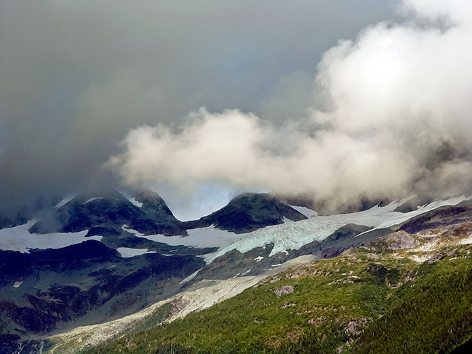
| Peaks in the Nusatsum Divide |
|
|
| View of the cloudy Nusatsum Divide from below Hammer Lake, near Odegaard Pass, Bella Coola, British Columbia. |
|
|
|
Prints available in the following sizes.
Please query for stock use.
|
| |
| O t h e r P h o t o D a t a |
Sony Cybershot F707
28mm
hand held
F5.6, 1/500 second
ISO 100
|
|
| |
| |
|
|
| Peaks in the Nusatsum Divide 2 |
|
|
| Clouds and sunlight on the Nusatsum Divide, Bella Coola, British Columbia. |
|
|
|
Prints available in the following sizes.
Please query for stock use.
|
| |
| O t h e r P h o t o D a t a |
Sony Cybershot F707
28mm
hand held
F5.6, 1/500 second
ISO 100
|
|
| |
| |
|
|
| Styx Mountain |
|
|
| Styx Mountain from the road to Purgatory Lookout, above Odegaard Pass on the Nusatsum Forest Service Road. Bella Coola, British Columbia. |
|
|
|
Prints available in the following sizes.
Please query for stock use.
|
| |
| O t h e r P h o t o D a t a |
Sony Cybershot F707
28mm
hand held
F5.6, 1/500 second
ISO 100
|
|
| |
| |
|
|
| Styx Mountain 2 |
|
|
View from the road to Purgatory Lookout, Bella Coola, British Columbia.
|
|
|
|
Prints available in the following sizes.
Please query for stock use.
|
| |
| O t h e r P h o t o D a t a |
Sony Cybershot F707
28mm
hand held
F5.6, 1/500 second
ISO 100
|
|
| |
| |
|
|
| Mown Fields, Tatla Lake |

|
|
| View of hay fields from the BC Highway 20, near Tatla Lake, British Columbia. |
|
|
|
Prints available in the following sizes.
Please query for stock use.
|
| |
| O t h e r P h o t o D a t a |
Sony Cybershot F707
28mm
hand held
F5.6, 1/500 second
ISO 100
|
|
| |
| |
|
|
|
|
| A l l P h o t o G a l l e r i e s |
|
Photo of the month |
|
New Additions |
| |
|
Alaska |
|
Alaska (aerial) |
|
British Columbia, Bella Coola |
|
California, Alabama Hills |
|
California, central coast |
|
California, central valley |
|
California, Death Valley |
|
California, Livermore Valley |
|
California, Sierra north |
|
California, Sierra south |
|
California, White Mountains |
|
California, Yosemite |
|
California, southern coast |
|
Europe, Russia |
|
Europe, Spain |
|
Europe, Italy |
|
Mexico, Michoacan |
|
Mexico, Monte Alban |
|
Midwestern US, Chicago |
|
Northwest, Cascades |
|
Northwest, Oregon Coast |
|
Northwest, Puget Sound |
|
Northwest, Toad Mountain |
|
Southwest, New Mexico |
|
Southeast Asia, Vietnam |
| |
|
Close ups, flowers |
| |
|