| Convict Lake |
|
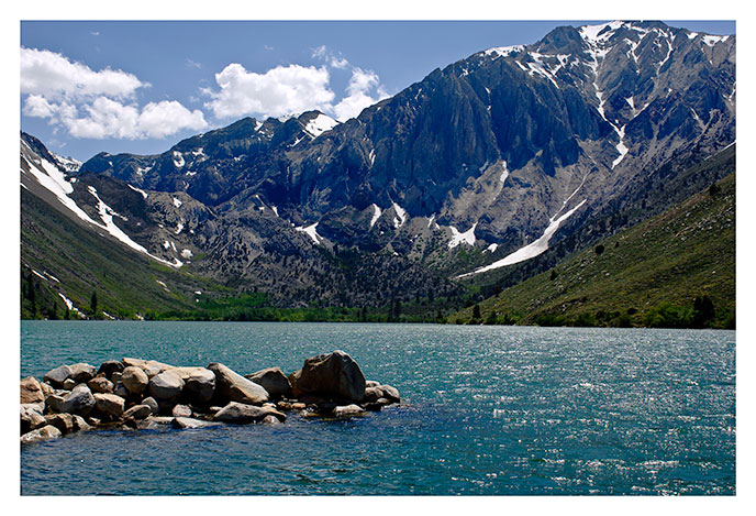
Convict Lake in late spring, looking west. Here's a history of the name, from Francis Farquar's 'Place Names of the High Sierra':
A band of convicts escaped from the Nevada state penitentiary at Carson City, September 17, 1871, and went south to Owens Valley. On the morning of September 24, a posse, led by Robert Morrison, encountered some of the convicts nears the head of what was then known as Monte Diablo Creek. Morrison was killed. The convicts escaped, but were captured a few days later and were lynched. The lake and creek were thenceforth called Convict. (Chalfant The Story of Inyo, 1922, pp. 214-220.)
|
Photo data
June 4, 2005
Nikon D2X
28mm
hand held
f11, 1/320 second
ISO 100
|
|
| |
| Lone Pine Peak |

|
|
Upper cliffs of Lone Pine Peak from the Alabama Hills.
|
Photo data
September 9, 2006
Nikon D2X
200mm
Hand held
f7.1, 1/640 second
ISO 100
|
|
| |
| Lone Pine Peak, Sunrise |

|
|
The photo to the right was taken from the front yard of my uncle's house in Lone Pine at about 5:30am in late September. A forest fire south of Lone Pine had left the sky the color of slate.
|
Photo data
September 9, 2006
Nikon D2X
70-200mm zoom (at 90mm)
tripod mounted
f14, 1/15 second
ISO 100
|
|
| |
| Mt. Tom from Sherwin Summit |

|
Mt. Tom (13,786 feet) is the monumental pyramid on the right, and is the dominant presence in the northern Ownes Valley near Rovanna. This view is from the top of the Sherwin Grade near Tom's Place.
This photo was taken in May, 2005. This was an unusually snowy year for the Sierra and many of the high southern passes didn't open til the fourth of July.
|
Photo data
June 4, 2005
Nikon D2X
28-70mm zoom (at 70mm)
Hand held
f11, 1/320 second
ISO 100
|
|
| |
| Basin Peak, Evening |

|
Basin Peak is the relatively unobtrusive next door neighbor of Mt. Tom, but in the evening light it manages to take on some of it's neighbor's monumental character.
|
Photo data
June 4, 2005
Nikon D2X
300mm lens
tripod mounted
f6.7, 1/1000 second
ISO 100
|
|
| |
| Mt. Conness |

|
|
Mt. Conness (12,789 feet) is the highest Yosemite Peak north of Tioga Pass. The true summit is hidden behind the peak of the ridge at right center. This view is from Sawmill Meadows, a campsite that is evidently more popular to mosquitos than campers to judge by their relative numbers.
|
Photo data
September 10, 2006
Nikon D2X
28-70mm zoom (at 52mm)
hand held
f8, 1/500 second
ISO 100
|
|
| |
| Yosemite Valley, Late Fall |

|
|
|
Photo data
Novenber 18, 1989
Nikon F2
28mm lens
hand held
Kodachrome 64
|
|
| |
| Lundy Lake |
|
|
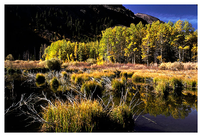
Lundy lake occupies a small basin on the east side of the Sierras above Mono Lake just north of Lee Vining. The basin is the historical site of the May Lundy Mine, a prominent silver mine of the late 1800s.
|
Photo data
October 2, 1988
Nikon F2
28mm lens
hand held
f5.6, 1/60 second
Kodachrome 64
|
|
| |
| White Mountain Peak |

|
|
Multi-colored White Mountain peak, from the ridge above Barcroft Lab, looking northwest.
|
Photo data
August 27, 2005
Nikon D2X
28-70mm zoom (at 62mm)
hand held
f16, 1/160 second
ISO 100
|
|
| |
| Boulders, Alabama Hills |
|
|
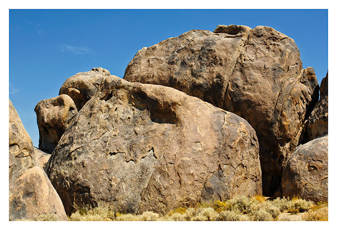
Boulders in the Alabama Hills, Owens Valley, California. The Alabama Hills are a large collection of boulders of this sort; piles of such boulders in fact. They are rather attractive as boulders go. Perhaps it's for this reason that many Hollywood films have chosen the Alabama Hills as a location to film westerns.
|
Photo data
September 9, 2006
Nikon D2X
38mm
Hand held
f6.3, 1/800 second
ISO 100
|
|
| |
| Tall Boulders, Alabama Hills |
|
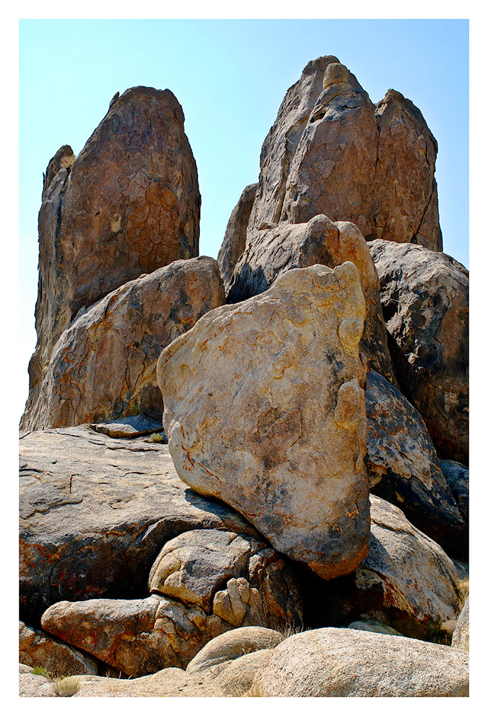
More Alabama Hill Boulders, Owens Valley, California. These are atypical stonhenge-type boulders--not many like this in the hills.
|
Photo data
September 9, 2006
Nikon D2X
28mm
Hand held
f7.1, 1/320 second
ISO 100
|
|
| |
| Sawmill Meadows |

|
|
Looking down on Sawmill meadows from an eminence to the east. Sawmill meadows resides in a small hanging valley east of Tioga Pass, California, just outside of Yoemite National Park. The rock plateau to the west of the meadows leads to the Sierra crest south of Mt. Conness.
|
Photo data
September 10, 2006
Nikon D2X
40mm
Hand held
f8, 1/500 second
ISO 100
|
|
| |
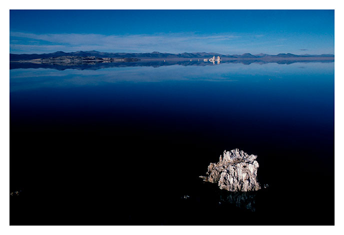
| Mono Lake, Minimalist View |
|
|
A minimalist view of Mono Lake from Navy Beach--one lone tufa stump in acres of calm water.
|
Photo data
October 2, 1988
Nikon F2
28mm lens
hand held
f5.6, 1/60 second
Kodachrome 64
|
|
| |
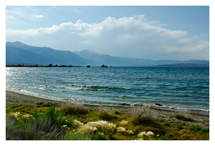
| Mono Lake With Fuzzy Grass |
|
Mono Lake from Navy Beach, with the pre-eminently fuzzy squirrel tail grass growing brightly in the foreground.
|
Photo data
July 5, 2007
Nikon D2X
28mm
Hand held
f11, 1/320 second
ISO 100
|
|
| |
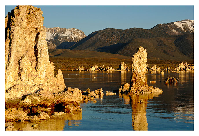
| Mono Lake, Early Morning |
|
|
Tufa formations at the south tufa area. In the distance is the Sierra crest near Mono Pass and Bloody Canyon.
|
Photo data
June 4, 2005
Nikon D2X
28-70mm zoom (at 56mm)
Hand held
f22, 1/50 second
ISO 100
|
|
| |
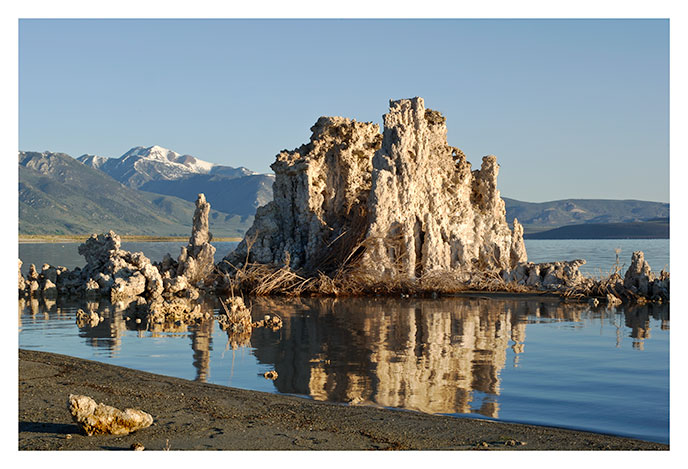
| Mono Lake, Tufa, Early Morning |
|
|
A tufa castle on the south shore of Mono Lake, California. Mt Dunderberg rises in the background to the left of the tufa.
|
Photo data
June 4, 2005
Nikon D2X
200mm
tripod mounted
f22, 1/20 second
ISO 100
|
|
| |
| Mono Lake, Tufa Silhouettes, Early Morning |

|
|
Tufa castles in silhouette against the rising sun, south shore of Mono Lake, California. The sand in the forground is unusually white from sodium bicarbonate and salt.
|
Photo data
June 4, 2005
Nikon D2X
28mm
tripod mounted
f22, 1/40 second
ISO 100
|
|
| |
| Cloud Above Mono Pass |
|
|
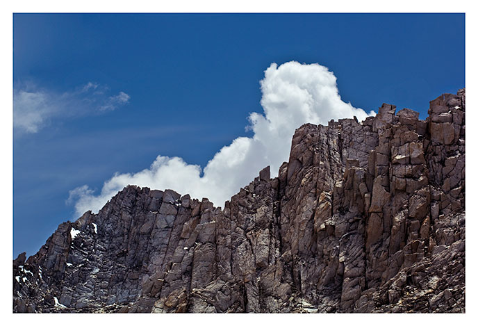
One of the day's many thunderheads, this one seeming to slowly crawl over the clifftops above Little Lakes Valley near Mono Pass.
|
Photo data
July 6, 2007
Nikon D2X
70-200mm zoom at 116mm
hand held
f9, 1/500 second
ISO 100
|
|
| |
| Mt. Abbot |
|
|
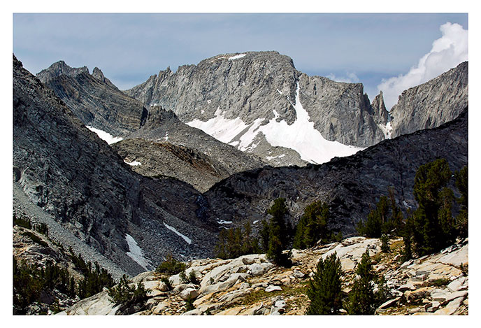
Mt. Abbot from the lower portion of the Mono Pass trail.
|
Photo data
July 6, 2007
Nikon D2X
70-200mm zoom at 116mm
hand held
f9, 1/500 second
ISO 100
|
|
| |
| Mt. Abbot |

|
|
This is a telephoto view of Mt. Abbot from Mono Pass.
|
Photo data
July 6, 2007
Nikon D2X
200mm
Hand held
f9, 1/500 second
ISO 100
|
|
| |
| Bear Creek Spire, Mt. Dade, and Mt. Abbot |
|
|
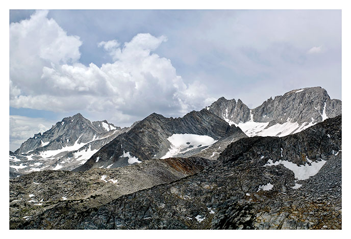
In the center of the picture is Treasure peak. This view from Mono Pass, with rain clouds building by fits and starts overt the eastern slope of the Sierra. The occasional rain showers were very welcome this day, with temperatures over 70 degrees at 11,000 feet.
|
Photo data
July 6, 2007
Nikon D2X
28-70mm zoom at 45mm
hand held
f9, 1/640 second
ISO 100
|
|
| |
| Keynot Peak |
|
|
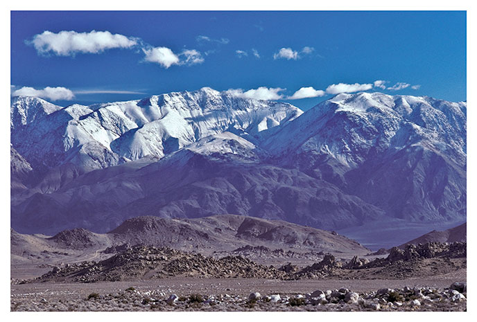
Keynot peak (11,102 ft) is at the center of the picture. This view is from high on the road to Whitney Portal, outside of Lone Pine California, looking east. The piles of rubble in the foreground are the Alabama Hills.
|
Photo data
February 14, 1991
Nikon F2
105mm lens
hand held
f5.6, 1/60 second
Kodachrome 64
|
|
| |
| Bear Creek Spire and Pond |
|
|
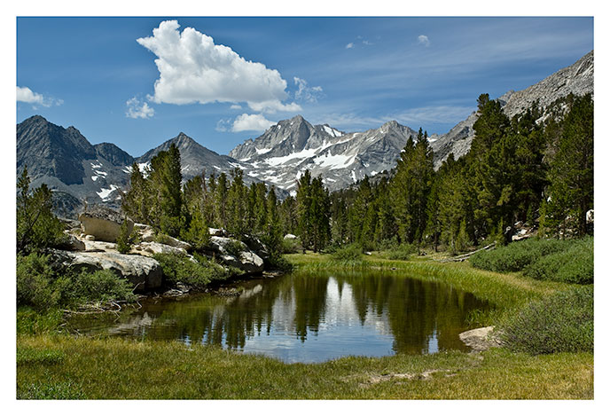
This picturesque little tarn is along the trail to Mono Pass, a few hundered feet above Little Lakes Valley. Bear Creek Spire is here crowned with a banner cloud.
|
Photo data
July 7, 2007
Nikon D2X
28-70mm zoom (at 32mm)
hand held
f9, 1/1500 second
ISO 100
|
|
| |
| Bear Creek Spire |

|
|
Early morning view of Bear Creek Spire from the floor of Little Lakes Valley near the start of the trail to Mono Pass.
|
Photo data
July 7, 2007
Nikon D2X
28-70mm zoom (at 32mm)
hand held
f9, 1/1500 second
ISO 100
|
|
| |
| Ridge South of Lone Pine |

|
|
Morning light on the ridge south of Lone Pine, California. A little alpenglow remains on the peaks while the rest of the ridge reflects light filtered through forest-fire smoke.
|
Photo data
September 9, 2006
Nikon D2X
90mm
tripod mounted
f13 1/8 second
ISO 100
|
|
| |
| High Sierra Crest Near Independence, California |

|
|
View of the high sierra crest from highway 395 in the late afternoon.
|
Photo data
April 9, 2010
Nikon D700
70 to 200mm zoom (102mm)
hand held
f9, 1/800 second
ISO 200
|
|
| |
| Mt. Williamson and High Sierra Crest |

|
|
View of Mt. Williamson (left) and the Sierra Nevada crest from highway 395 in the late afternoon.
|
Photo data
April 9, 2010
Nikon D700
70 to 200mm zoom (190mm)
hand held
f9, 1/500 second
ISO 200
|
|
| |
| Sierra Crest; Lone Pine Peak |

|
|
|
Photo data
April 12, 2010
Nikon D700
70 to 200mm zoom (125mm)
tripod mounted
f9, 1 second
ISO 200
|
|
| |
| Lone Pine Peak, Mt. Whitney, High Sierra Crest Near Lone Pine, California |

|
|
Morning view of Lone Pine Peak and Mt. Whitney, shortly after dawn, with the rocks of the Alabama Hills in the foreground.
|
Photo data
April 10, 2010
Nikon D700
70mm to 200mm zoom (102mm)
tripod mounted
f11, 1/200 second
ISO 200
|
|
| |
| Lone Pine Peak from the Alabama Hills |

|
|
Morning view of the Sierra crest around Lone Pine Peak after a storm.
|
Photo data
April 12, 2010
Nikon D700
70mm to 200mm zoom (110mm)
tripod mounted
f7.1, 1/600 second
ISO 200
|
|
| |


